OVERVIEW
The UTM Data Centre is responsible for managing spatial data acquired during oceanographic cruises on board Spanish CSIC research vessels and RV Hespérides.
The aim is, on the one hand, to disseminate which data exist and where, how and when they have been acquired. And on the other hand, to provide access to as much of the interoperable data as possible, following the FAIR principles, so that they can be used and reused.
For this purpose, the UTM has a Spatial Data Infrastructure at a national level that consists of several services.
At an international level, the UTM is a National Oceanographic Data Centre (NODC) of the Distributed European Marine Data Infrastructure SeaDataNet, to which the UTM provides metadata published in the Cruise Summary Report Inventory and in the data catalog Common Data Index Catalogue, as well as open data to be shared.
Search & Access Data
Including metadata from more than 800 cruises carried out since 1979, with links to documentation associated to the cruise, navigation maps and datasets
Geospatial data mapping interface
data viewers
Underway Viewer: meteorological data and temperature and salinity of sea surface
SVP Viewer: Sound Velocity Profiles
Real Time Fleet: RT position and data from research vessels
Processing
The UTM Data Processing aims to offer a national service in the processing and analysis of oceanographic data, in addition to performing quality control of the data acquired in the vessels managed by the UTM.
For more information please contact us or visit the
CSIC
Catalogue of scientific-technical services
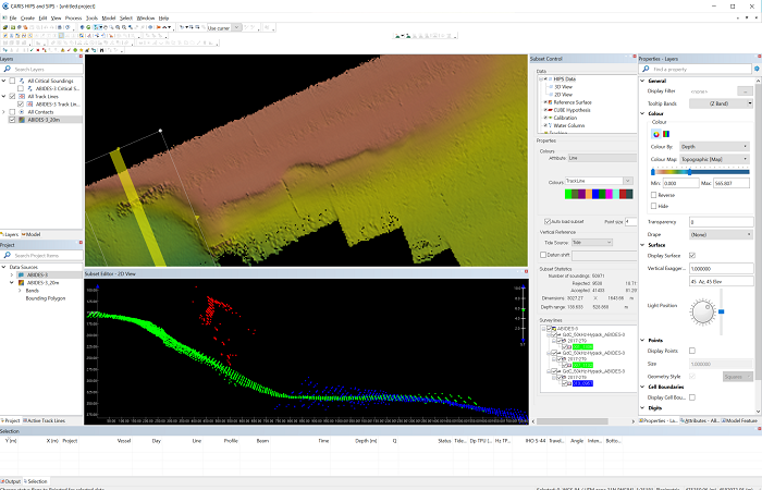
CARIS HIPS&SIPS
Multibeam and Side Scan Sonar data processing
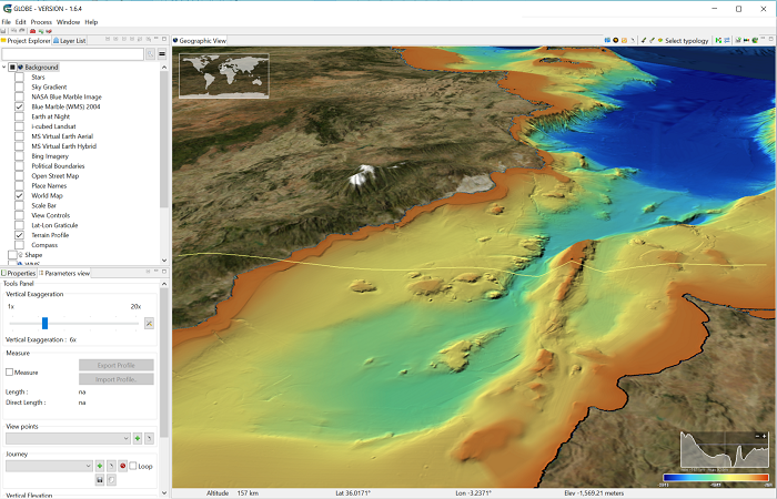
GLOBE
Bathymetry processing and 3D oceanographic data visualization
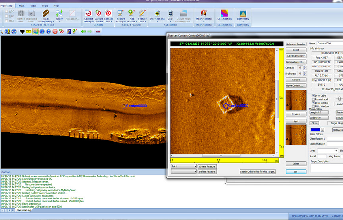
SONAR WIZ
Side Scan Sonar Data processing
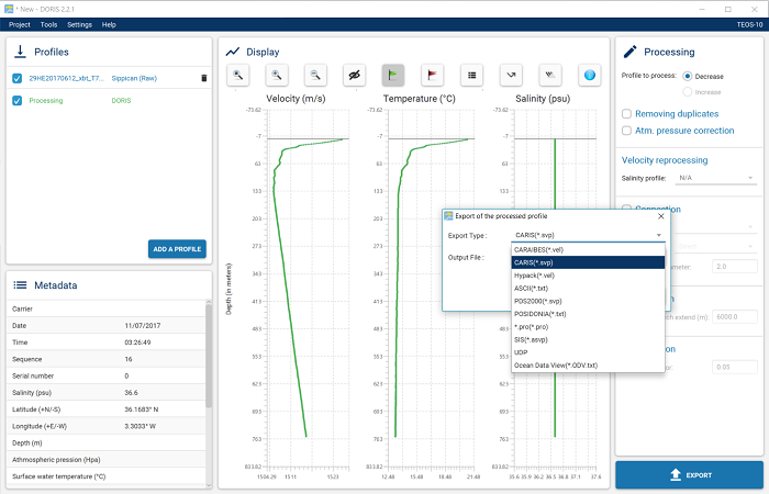
DORIS
Processing and conversion of S, T and V profiles
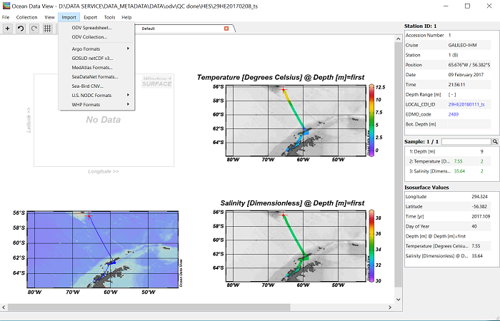
OCEAN DATA VIEW (ODV)
Oceanographic data analysis and visualization
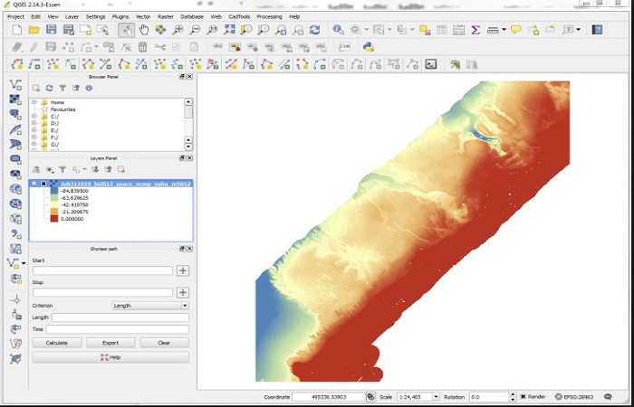
QGIS
Geographic Information System (GIS) Open source
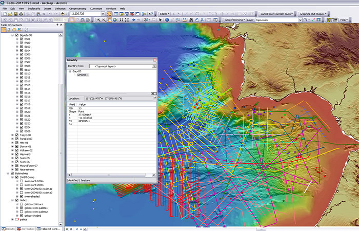
ARCGIS DESKTOP
Geographic Information System (GIS)
MIKADO
Generation of metadata
Projects
The UTM is partner in different European Projects related to data magement:
Collaborations
CSIC institutional repository
DIGITAL.CSIC organizes, preserves and disseminates CSIC research results in open access.
DataCite provides persistent identifiers (DOIs) for research data
The UTM Data Centre is able to assign DOIs for research data through the CSIC membership
PAN-EUROPEAN INFRASTRUCTURE FOR OCEAN & MARINE DATA MANAGEMENT
UTM-CSIC Data Centre is a National Oceanographic Data Centre (NODC) of SeaDataNet

COPERNICUS MARINE SERVICES
Real-time (RT) data from Odón de Buen, Sarmiento de Gamboa and Hespérides RVs’ TSG contribute to DataGlobal Ocean near–real-time (NRT) in situ quality-controlled observations, updated hourly.

CDS-Coriolis marine in situ observations
Real-time (RT) data from Odón de Buen, Sarmiento de Gamboa and Hespérides RVs’ TSG contribute to CORIOLIS

Marine environment information system
Information related to the marine environment generated by different administrations and other Spanish organizations, including UTM-CSIC Data Centre

IOC Ocean Data and Information System CATALOGUE
The ODIS «Catalogue of Sources», online browsable and searchable catalogue of existing ocean related web-based sources/systems of data and information as well as products and services, includes UTM-CSIC Data Centre infrastructure
Data Policy
The UTM Data Policy seeks to promote access to its data archives, subject to conditions under which data has been collected. In this context, we are working to make as much data open and available online as possible.
Data request
Using this form, you can request access to an open or restricted dataset published in our catalogue
Contact us
UTM – CSIC Data Centre